Discover the Joys of Beach Running
A Bitchin' Coastal Activity
Embrace the invigorating experience of running along the pristine shores of North Topsail Beach and Surf City. Feel the ocean breeze and soak in the stunning views as you embark on a journey like no other.
For the best running routes in North Topsail Beach, NC, the most popular choice is to run along the beach itself, offering beautiful scenery and a flat, sandy surface; you can also explore the quieter residential streets, or consider using the dedicated walking paths near the pier and along the beachfront depending on your desired distance and terrain.
Key running options in North Topsail Beach:
- Beachfront running: The most scenic option, offering a flat, wide path with ocean views.
- Residential streets: Explore quieter neighborhoods for a more varied running experience with less foot traffic.
Pier area pathways: Utilize the walking paths around the pier for a combination of beach views and flat terrain. - Considerations when choosing a route:
- Tide level: Check the tide schedule to avoid running on very narrow or flooded beach areas.
Time of day: Early mornings or evenings are generally less crowded on the beach. - Weather conditions: Be aware of strong winds and potential rain when planning your run.
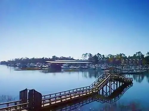
Note Worthy North Carolina Coastal Trails

Jacksonville-Camp LeJeune Rail-to-Trails
The Jacksonville-Camp LeJeune Rail-to-Trails path extends along a former rail corridor between the Marine Corps base at Camp LeJeune (Midway Park area) and Marine Boulevard in Jacksonville, located 6.3 miles northwest.
More...
About the Route
The rail-trail portion of the Jacksonville-Camp LeJeune Greenways leaves off in the north from Marine Blvd. A section of the trail follows along Marin Blvd. while another section travels southeast largely alongside Lejeune Blvd. The trail comes to its southern endpoint at the entrance to the Camp LeJeune Marine Corps Base, effectively connecting the military and civilian regions of the community.
Parking and Trail Access
The Jacksonville-Camp Lejeune Rails-to-Trails runs between Chaney Ave (Jacksonville) and Holcomb Blvd (Camp LeJeune).
Parking is available at:
Onslow Drive between US 17/Marine Blvd. and Eastwood Drive
Greyhound Bus Stop, 1300 N Marine Blvd (Jacksonville)
Bell Fork Rd near where it intersects with the US 17 Bypass (northwest of the Bypass)
These are approximate addresses, please see TrailLink Map for more detailed directions.
View at Trail Link

Military Cutoff Trail
The Military Cutoff Trail is a paved, north-south route paralleling its namesake roadway on the east end of Wilmington. A wide grassy median separates the trail from the busy roadway. The south end of the trail has an urban
More...
The Military Cutoff Trail is a paved, north-south route paralleling its namesake roadway on the east end of Wilmington. A wide grassy median separates the trail from the busy roadway. The south end of the trail has an urban
On the trail’s southern end, it connects to a segment of the Gary Shell Cross-City Trail, a developing pathway that connects to the University of North Carolina and many of the city’s premier parks.
View on Trail Link

Emerald Path
The Emerald Path is an 11-mile multiuse pathway stretching from the Indian Beach town limits all the way to The Point at Bogue Inlet at the western end of Emerald Isle.
More...
The Emerald Path is an 11-mile multiuse pathway stretching from the Indian Beach town limits all the way to The Point at Bogue Inlet at the western end of Emerald Isle.
About the Route
The path follows Emerald Drive/NC 58, passing through a diversity of landscapes, including grassy areas, shady woodlands and the heart of downtown. There is a variety of shopping and dining options alongside the trail as well as a grocery store, a pharmacy, and multiple surf shops. Because the island is narrow, and as the pathway sits on its spine, it’s possible to view most of the island from there. There are plenty of beach access points no further than a block or two off the path.
Connections
The Emerald Path is part of the developing East Coast Greenway, a 3,000-mile route between Florida and Maine.
Parking and Trail Access
The Emerald Path runs between the intersection of Old Coast Guard Rd & Ring St (Emerald Isle) and Emerald Dr/NC 58 (Emerald Isle).
Parking is available at:
Station Street Public Parking, 11001 Station St (Emerald Isle)
Emerald Isle Woods Park, 9404 Coast Guard Rd (Emerald Isle)
Senator Jean Preston Memorial Park, 6813 Canal Dr (Emerald Isle)
Visit the TrailLink map for all parking options and detailed directions.
River to the Sea
The River to the Sea Bikeway (WMPO Bicycle Route 1) is an 11-mile, on- and off-road bicycle route that follows the Historic Beach Car Line, which carried ...
More...
... vacationers from downtown Wilmington to Wrightsville Beach by trolley. The bikeway is comprised of neighborhood residential streets, off-road multi-use paths, and a few busy arterial roadways.
Length: 11 miles
Trail end points: Market St & Water St and Lumina Ave at US 74 (Jonny Mercer's Pier)
Trail surfaces: Asphalt
Trail category: Rail-Trail
It begins at the foot of Market Street at the Riverwalk, with the Battleship USS North Carolina visible across the Cape Fear River. The bikeway then traverses the Old Wilmington, Bottom, and Forest Hills neighborhoods before crossing Independence Boulevard and passing by Empie Park. In the park, you can connect to the Gary Shell Cross-City Trail, a 15-mile route that links other parks, Wrightsville Beach, the UNC-Wilmington campus, and the Autumn Hill community.
From Empie Park to South Kerr Avenue, the bikeway follows Park Avenue, a quiet local street that passes by Audubon Station. After merging with South Kerr Avenue and crossing South College Road, the bikeway passes through the Winter Park area on Pine Grove Drive and McMillan Avenue before joining up with Park Avenue again. Between Wallace Avenue and 52nd Street, the bikeway uses an off-road path, with a spur to the University of North Carolina at Wilmington (WMPO Bicycle Route 1A) via Wooddale Drive.
Between 52nd Street and Hinton Avenue, the route follows on-road bicycle lanes on Park Avenue. Beyond Greenville Avenue, the ride is much more uncomfortable for recreational cyclists. Oleander Drive and Wrightsville Avenue are busy arterial roadways with few bicycle facilities and high-speed traffic, and there are several bridges to cross. This section is not recommended for recreational cyclists.
Parking and Trail Access
To reach the downtown Wilmington trailhead, follow U.S. Highway 74 toward Wilmington; take the Wilmington DOWNTOWN exit. Proceed south on North 3rd Street. Take a right onto Market Street and follow it west to Riverfront Park. Parking is available on-street or in the city of Wilmington parking deck located at Market Street and North 2nd Street. The bikeway begins at the foot of Market Street at North and South Water Street. Follow the bicycle Route 1 signs.
To reach the Empie Park parking area, follow U.S. Highway 76 to Independence Boulevard northbound. Take a right onto Park Avenue and an immediate left into the park driveway. The bikeway is on Park Avenue. Follow the bicycle Route 1 signs.
To reach the Wrightsville Beach trailhead, follow U.S. Highway 74 toward Wrightsville Beach. At the intersection of Salisbury Street and North Lumina Avenue, continue straight on Salisbury Street to the on-street parking area. The bikeway begins on Salisbury Street west of North Lumina Avenue. Follow the bicycle Route 1 signs.
There is also parking at the Wrightsville Beach municipal complex at the intersection of Salisbury Street and Seawater Lane.
View on TrailLink

Serenity point is a North Carolina beach run that is among the most spectacular runs anywhere. Wether you like a short one milers, a 5K, 10K or even half to full marathon, you can achieve that starting at Serenity Point.


More...
Sledgehammer Beach Run at Serenity Point
Serenity Point Topsail Running is a running event that takes place on the beach in North Topsail Beach, North Carolina. The event is part of the Sledgehammer Beach Run series, which is organized by Semper Fi & America's Fund.
What to expect:
Run on the beach in North Topsail Beach
Take in the views of the area
Participate in a half marathon
Where to find more information:
The Sledgehammer Beach Run series website has information about the event, including the date and time
Related running club:
The Topsail Area Running Club (T.A.R.C.) is a social running club for runners of all abilities in the Topsail area. The club meets weekly at various locations on the island and has post-run socials at local restaurants and tap rooms.
Unmatched Ocean Views
Immerse yourself in breathtaking ocean vistas that accompany every step of your run. The perfect backdrop for an unforgettable coastal experience.
Serene Beach Trails
Explore tranquil trails that wind through picturesque landscapes, offering a peaceful escape from the hustle and bustle.
Vibrant Coastal Wildlife
Encounter the diverse marine life and vibrant ecosystems that thrive along the shoreline, adding a touch of wonder to your run.

Captivating Coastal Moments
A Visual Journey Through Beach Running Adventures


What Our Guests Say
"From the Bitchin' Breach House, my favorite route is running past the Tiki Bar on New River Inlet Road, then take a right at the Beach Access about a quarter mile up the road..."
More...
The name of the road is Oyster Lane. It is well marked by the path and the very obvious Beach Access Sign. Once out on the sand and especially at low tide (the beach house has a tide clock), you can run along the ocean on firm well packed sand. Watch step as there are a lot of sea shells along this beach. If you leave the Bitchin' Beach House early enough, you will catch the sunrise over the ocean.
Janet A.
"The Bitchin Beach House was the perfect base for our beach running adventures. The proximity to the ocean made it easy to start our day with a refreshing run. "
More...
If you have the legs for it, be sure to run up and along the beach at the ORV beach access. If you go early enough, you won't see many regular beach users, though you might trip on a surf fisherman. I highly recommend this run.
Michael R.
"I loved the serene atmosphere of Surf City. Running on the beach was both invigorating and peaceful. The ocean breeze was the perfect companion. A must-visit for any beach runner! "
More...
I've always found parking near the Surf City pier. Granted, depending upon the waves, one may have to compete with the surfers for a spot. Up the beach or down the beach; it doesn't matter. Either direction affords runners miles of unspoiled beauty. The same can be said for Serenity point, which is even offers miles of unspoiled beauty. I've even found some amazing sea shells along the Serenity Point route 🙂
Larry A.
Why Choose Us
Bitchin' Beach Running Base
Steps from the Beach
Our location offers direct access to the beach, making it easy to start your run with the sound of waves.
Panoramic Ocean Views
Enjoy stunning ocean views from our accommodations, providing a perfect backdrop for your stay.
Spacious Accommodations
With room for up to twelve guests, our beach house is ideal for group running retreats.
Outdoor Shower
Rinse off after your run with our convenient outdoor shower, keeping the sand where it belongs.
Private Deck
Relax and unwind on our private deck, perfect for post-run stretching and relaxation.
Modern Amenities
Enjoy all the comforts of home with our fully equipped kitchen and modern living spaces.
Book Your Stay Today
Don't miss out on the ultimate beach running experience at the Bitchin Beach House. Book your stay now and enjoy the perfect blend of relaxation and adventure on the beautiful shores of North Topsail Beach.
